Geolocate

Slamet topographic map

Click on the map to display elevation.

About this map

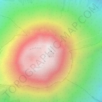
Name: Slamet topographic map, elevation, terrain.

Location: Slamet, Pemalang, Central Java, Java, Indonesia (-7.24152 109.21492 -7.24142 109.21502)

Average elevation: 2,951 m

Minimum elevation: 2,382 m

Maximum elevation: 3,412 m

Gear up for your next adventure:

🧤Thermal Touchscreen Gloves - Stay warm while operating your GPS or smartphone camera
📷Outdoor Action Cameras - Cameras designed for hiking and adventure
Altimeter Watches - Watches measuring altitude for mountain activities
🧗Locking Carabiners - Secure gear to your pack or for light technical use
🛑Emergency Bivvy Bags - Heat-reflective survival bags for unexpected nights out

As an Amazon Associate, this site earns from qualifying purchases at no extra cost to you.