Geolocate

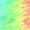
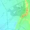
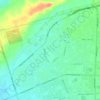
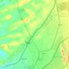
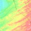
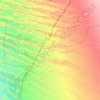
Al Noud topographic map

Click on the map to display elevation.

About this map

Name: Al Noud topographic map, elevation, terrain.

Location: Al Noud, Al Khirayr, Al Ain, Abu Dhabi Emirate, United Arab Emirates (24.13256 55.80066 24.17256 55.84066)

Average elevation: 320 m

Minimum elevation: 308 m

Maximum elevation: 331 m

Other topographic maps

Click on a map to view its topography, its elevation and its terrain.
Zakhir

United Arab Emirates > Abu Dhabi Emirate > Al Ain

Average elevation: 240 m

Mazyad

United Arab Emirates > Abu Dhabi Emirate > Al Ain

Average elevation: 328 m

Ni'mah

United Arab Emirates > Abu Dhabi Emirate > Al Ain

Average elevation: 246 m

Sa'

United Arab Emirates > Abu Dhabi Emirate > Al Ain

Average elevation: 399 m

Nahil

United Arab Emirates > Abu Dhabi Emirate > Al Ain

Average elevation: 224 m

Gear up for your next adventure:

📱Phone Mounts for Hiking - Secure mounts to carry your phone on trails
🔋Lithium AA Batteries - Long-lasting power that performs well in cold mountain weather
🕶️Glacier Goggles - Maximum protection for high-altitude snow topography
🛰️Satellite Messengers - Emergency communication devices for areas without mobile signal
🧘Folding Sit Mats - Dry and warm seat for map-reading breaks on damp ground

As an Amazon Associate, this site earns from qualifying purchases at no extra cost to you.