Geolocate

Licantén topographic map

Click on the map to display elevation.

About this map
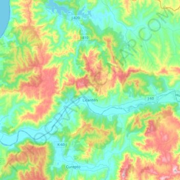
Name: Licantén topographic map, elevation, terrain.

Location: Licantén, Provincia de Curicó, Maule Region, Chile (-35.05932 -72.18708 -34.87945 -71.83108)

Average elevation: 165 m

Minimum elevation: 0 m

Maximum elevation: 570 m

Gear up for your next adventure:

🥫Expedition Meals - Lightweight, high-calorie nutrition for long-distance hikers
👟Waterproof Leg Gaiters - Keep mud and water out of your boots in boggy terrain
⛺Camping Shelters - Emergency and lightweight shelters for outdoor use
🪢Paracord - Multi-purpose cord for camping and survival
🧦Hiking Socks - Breathable socks designed to prevent blisters on long walks

As an Amazon Associate, this site earns from qualifying purchases at no extra cost to you.