Geolocate

Surcubamba topographic map

Click on the map to display elevation.

About this map
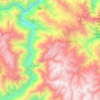
Name: Surcubamba topographic map, elevation, terrain.

Location: Surcubamba, Province of Tayacaja, Huancavelica, Peru (-12.28873 -74.75907 -12.03044 -74.52184)

Average elevation: 2,922 m

Minimum elevation: 1,099 m

Maximum elevation: 4,572 m

Gear up for your next adventure:

🥤Hydration Bladders - Hands-free hydration systems for backpacks
🛌Sleeping Bags - Warm and packable sleeping bags for outdoor nights
🔋Solar Power Banks - Keep your GPS and phone charged during multi-day expeditions
🥾Trekking Poles - Poles to improve stability on uneven terrain
👟Heavy Duty Boot Laces - Always carry a spare for your hiking footwear

As an Amazon Associate, this site earns from qualifying purchases at no extra cost to you.