Geolocate

Carrick topographic map

Click on the map to display elevation.

About this map

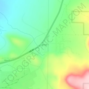
Name: Carrick topographic map, elevation, terrain.

Location: Carrick, Siskiyou County, California, United States (41.44414 -122.36610 41.45073 -122.36185)

Average elevation: 1,081 m

Minimum elevation: 1,001 m

Maximum elevation: 1,227 m

Gear up for your next adventure:

🥾Walking Shoes - Lightweight walking shoes for countryside and coastal paths
📍Handheld GPS Navigators - Reliable satellite navigation for hiking and off-road exploration
🧺Ultralight Dry Bags - Organize and waterproof your gear inside your rucksack
🛑Emergency Bivvy Bags - Heat-reflective survival bags for unexpected nights out
🔭Compact Hiking Binoculars - Lightweight optics for scouting terrain and spotting wildlife

As an Amazon Associate, this site earns from qualifying purchases at no extra cost to you.