
Macomb topographic map
Interactive map
Click on the map to display elevation.
About this map
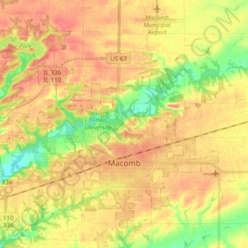
Name: Macomb topographic map, elevation, terrain.
Location: Macomb, McDonough County, Illinois, 61455, United States (40.43110 -90.75720 40.51983 -90.61879)
Average elevation: 207 m
Minimum elevation: 176 m
Maximum elevation: 226 m
Other topographic maps
Click on a map to view its topography, its elevation and its terrain.
Sciota
United States > Illinois > McDonough County
Sciota, McDonough County, Illinois, United States
Average elevation: 231 m