Geolocate

Ruthven topographic map

Click on the map to display elevation.

About this map

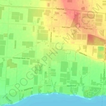
Name: Ruthven topographic map, elevation, terrain.

Location: Ruthven, Kingsville, Essex County, Ontario, N0P 2G0, Canada (42.03210 -82.69057 42.07210 -82.65057)

Average elevation: 202 m

Minimum elevation: 172 m

Maximum elevation: 230 m

Gear up for your next adventure:

🎒Multi-day Trekking Packs - Large capacity backpacks for wild camping and long-distance trails
📢Survival Whistles - Essential safety gear for signaling for help in mountain fog
🧣Neck Gaiters - Versatile protection against wind and cold
📦Dry Bags - Waterproof bags to protect gear from rain
👖Convertible Hiking Trousers - Versatile zip-off pants for changing mountain weather conditions

As an Amazon Associate, this site earns from qualifying purchases at no extra cost to you.