Geolocate

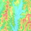
Capriglio topographic map

Click on the map to display elevation.

About this map

Name: Capriglio topographic map, elevation, terrain.

Location: Capriglio, Asti, Piedmont, Italy (44.98994 7.99406 45.02468 8.02679)

Average elevation: 225 m

Minimum elevation: 183 m

Maximum elevation: 281 m

Other topographic maps

Click on a map to view its topography, its elevation and its terrain.

Gatti

Italy > Piedmont > Asti > Rocchetta Tanaro

Average elevation: 165 m

Sant'Andrea

Italy > Piedmont > Asti > Cerreto d'Asti

Average elevation: 270 m

Zolfo

Italy > Piedmont > Asti > Montafia

Average elevation: 226 m

Gear up for your next adventure:

🔭Compact Hiking Binoculars - Lightweight optics for scouting terrain and spotting wildlife
🧘Folding Sit Mats - Dry and warm seat for map-reading breaks on damp ground
🎒Backpack Rain Covers - Universal waterproof covers to protect your gear from downpours
🥾Hiking Boots - Waterproof and durable boots for long-distance hiking in the UK
🌂Windproof Trekking Umbrellas - Surprising but effective rain protection on low-wind trails

As an Amazon Associate, this site earns from qualifying purchases at no extra cost to you.