Geolocate

Graham topographic map

Click on the map to display elevation.

About this map

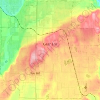
Name: Graham topographic map, elevation, terrain.

Location: Graham, Pierce County, Washington, United States (46.98000 -122.36776 47.09643 -122.19882)

Average elevation: 182 m

Minimum elevation: 49 m

Maximum elevation: 353 m

Gear up for your next adventure:

🧭Professional Hiking Compasses - High-precision liquid-filled compasses for map reading and orientation
🧴Tick Removal Tools - Small, essential health tool for UK woodland and moorland
🧼Camping Hygiene Kits - Compact hygiene essentials for outdoor stays
🧦Merino Wool Hiking Socks - Moisture-wicking socks to prevent blisters during long mountain walks
🧤Thermal Touchscreen Gloves - Stay warm while operating your GPS or smartphone camera

As an Amazon Associate, this site earns from qualifying purchases at no extra cost to you.