Geolocate

Thurlby topographic map

Click on the map to display elevation.

About this map
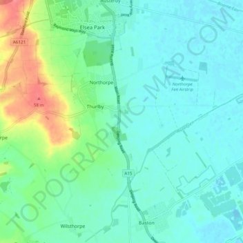
Name: Thurlby topographic map, elevation, terrain.

Location: Thurlby, South Kesteven, Lincolnshire, Greater Lincolnshire, England, United Kingdom (52.71396 -0.40006 52.75623 -0.30452)

Average elevation: 15 m

Minimum elevation: -3 m

Maximum elevation: 62 m

Lincolnshire trails, hiking, mountain biking, running and outdoor activities

Other topographic maps

Click on a map to view its topography, its elevation and its terrain.

Gear up for your next adventure:

🩹Hiking First Aid Kits - Compact medical kits tailored for trail injuries and emergencies
👖Convertible Hiking Trousers - Versatile zip-off pants for changing mountain weather conditions
⛺Lightweight Solo Tents - Backpacking tents designed for wild camping in the UK highlands
🗺️Topographic Maps - Detailed maps showing elevation and terrain features
💧Hydration Reservoirs - Convenient water bladders for hands-free drinking on the move

As an Amazon Associate, this site earns from qualifying purchases at no extra cost to you.