
Ife topographic map
Interactive map
Click on the map to display elevation.
About this map
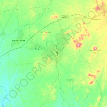
Name: Ife topographic map, elevation, terrain.
Location: Ife, Ife Central, Osun State, 220282, Nigeria (7.32282 4.40045 7.64282 4.72045)
Average elevation: 278 m
Minimum elevation: 150 m
Maximum elevation: 654 m
Other topographic maps
Click on a map to view its topography, its elevation and its terrain.
Kajola
Nigeria > Osun State > Ife Central
Kajola, Ife Central, Osun State, 220282, Nigeria
Average elevation: 259 m