Geolocate

Ratzeburg topographic map

Click on the map to display elevation.

About this map
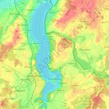
Name: Ratzeburg topographic map, elevation, terrain.

Location: Ratzeburg, Herzogtum Lauenburg, Schleswig-Holstein, Germany (53.67029 10.72670 53.78144 10.82688)

Average elevation: 39 m

Minimum elevation: -1 m

Maximum elevation: 88 m

Gear up for your next adventure:

🔋Lithium AA Batteries - Long-lasting power that performs well in cold mountain weather
🔦Keychain LED Torches - Emergency backup light for finding gear in your pack
🧘Folding Sit Mats - Dry and warm seat for map-reading breaks on damp ground
🗺️Ordnance Survey Maps - Official UK maps for walking and outdoor activities
🎒Hiking Child Carriers - Explore the outdoors with the whole family safely

As an Amazon Associate, this site earns from qualifying purchases at no extra cost to you.