
Victoria topographic map
Interactive map
Click on the map to display elevation.
About this map
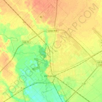
Name: Victoria topographic map, elevation, terrain.
Location: Victoria, Victoria County, Texas, United States (28.76331 -97.05143 28.90575 -96.90027)
Average elevation: 30 m
Minimum elevation: 11 m
Maximum elevation: 45 m
Victoria is a small city in South Texas and county seat of Victoria County, Texas. The population was 65,534 as of the 2020 census. The three counties of the Victoria Metropolitan Statistical Area had a population of 111,163 as of the 2000 census. Its elevation is 95 ft (29 m).