Geolocate

Navidad topographic map

Click on the map to display elevation.

About this map
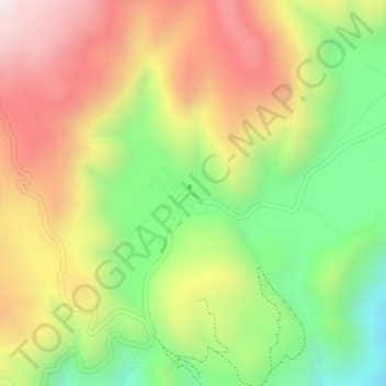
Name: Navidad topographic map, elevation, terrain.

Location: Navidad, Mascota, Jalisco, 46930, Mexico (20.56971 -104.67691 20.57422 -104.66835)

Average elevation: 1,964 m

Minimum elevation: 1,665 m

Maximum elevation: 2,240 m

Gear up for your next adventure:

🔦Head Torches - Hands-free lighting for hiking and camping
🎒Hiking Child Carriers - Explore the outdoors with the whole family safely
📐Altimeters & Barometers - Tools for measuring altitude and air pressure
📸Action Camera Chest Mounts - Record your ascent following topographic paths hands-free
🌦️Portable Weather Meters - Handheld tools for monitoring weather conditions

As an Amazon Associate, this site earns from qualifying purchases at no extra cost to you.