Geolocate

Zoverallo topographic map

Click on the map to display elevation.

About this map
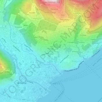
Name: Zoverallo topographic map, elevation, terrain.

Location: Zoverallo, Verbania, Verbano-Cusio-Ossola, Piedmont, 28921, Italy (45.92696 8.55464 45.96696 8.59464)

Average elevation: 322 m

Minimum elevation: 189 m

Maximum elevation: 767 m

Other topographic maps

Click on a map to view its topography, its elevation and its terrain.

Gear up for your next adventure:

🎒Hiking Daypacks - Compact backpacks ideal for short hikes and excursions
🦶Anti-Blister Balms - Protect your feet before long topographic expeditions
👕Technical Hiking Tees - Moisture-management for high-exertion climbs
🗺️Topographic Maps - Detailed maps showing elevation and terrain features
📻Hand-Crank Emergency Radios - Stay updated on weather warnings in remote areas

As an Amazon Associate, this site earns from qualifying purchases at no extra cost to you.