
Stoke Hammond topographic map
Interactive map
Click on the map to display elevation.
About this map
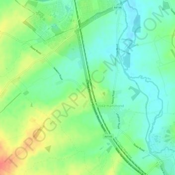
Name: Stoke Hammond topographic map, elevation, terrain.
Location: Stoke Hammond, Buckinghamshire, England, United Kingdom (51.94341 -0.75306 51.97786 -0.70393)
Average elevation: 88 m
Minimum elevation: 68 m
Maximum elevation: 124 m