
Thank you for supporting this site ❤️
Make a donation
Make a donation
Gear up for your next adventure:
As an Amazon Associate, this site earns from qualifying purchases at no extra cost to you.
Rajendranagar topographic map
Click on the map to display elevation.
Thank you for supporting this site ❤️
Make a donation
Make a donation
Gear up for your next adventure:
As an Amazon Associate, this site earns from qualifying purchases at no extra cost to you.
About this map
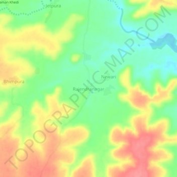
Name: Rajendranagar topographic map, elevation, terrain.
Location: Rajendranagar, Agar Tahsil, Agar Malwa, Madhya Pradesh, India (23.57181 76.02938 23.61181 76.06938)
Average elevation: 469 m
Minimum elevation: 432 m
Maximum elevation: 508 m
Thank you for supporting this site ❤️
Make a donation
Make a donation
Gear up for your next adventure:
As an Amazon Associate, this site earns from qualifying purchases at no extra cost to you.