
Akureyri topographic map
Interactive map
Click on the map to display elevation.
About this map
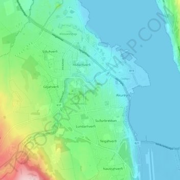
Name: Akureyri topographic map, elevation, terrain.
Location: Akureyri, Akureyrarbær, Northeastern Region, Iceland (65.66045 -18.15952 65.70736 -18.06580)
Average elevation: 51 m
Minimum elevation: -6 m
Maximum elevation: 315 m