
Thank you for supporting this site ❤️
Make a donation
Make a donation
Gear up for your next adventure:
As an Amazon Associate, this site earns from qualifying purchases at no extra cost to you.
Borduria topographic map
Click on the map to display elevation.
Thank you for supporting this site ❤️
Make a donation
Make a donation
Gear up for your next adventure:
As an Amazon Associate, this site earns from qualifying purchases at no extra cost to you.
About this map
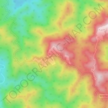
Name: Borduria topographic map, elevation, terrain.
Location: Borduria, Khonsa HQ, Tirap, Arunachal Pradesh, 792130, India (27.00931 95.45571 27.04931 95.49571)
Average elevation: 556 m
Minimum elevation: 318 m
Maximum elevation: 799 m
Thank you for supporting this site ❤️
Make a donation
Make a donation
Gear up for your next adventure:
As an Amazon Associate, this site earns from qualifying purchases at no extra cost to you.