
Make a donation
Gear up for your next adventure:
As an Amazon Associate, this site earns from qualifying purchases at no extra cost to you.
Gabaston topographic map
Click on the map to display elevation.
Make a donation
Gear up for your next adventure:
As an Amazon Associate, this site earns from qualifying purchases at no extra cost to you.
About this map
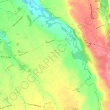
Name: Gabaston topographic map, elevation, terrain.
Average elevation: 308 m
Minimum elevation: 261 m
Maximum elevation: 351 m
Make a donation
Gear up for your next adventure:
As an Amazon Associate, this site earns from qualifying purchases at no extra cost to you.
Other topographic maps
Click on a map to view its topography, its elevation and its terrain.
Col de la Pierre Saint-Martin
France > Nouvelle-Aquitaine > Pyrénées-Atlantiques > Arette
Col de la Pierre Saint-Martin (elevation 1,766 m (5,794 ft)) is a mountain pass on the France-Spain border in the western Pyrenees in the department of Pyrénées-Atlantiques (France) and Navarra (Spain). The climb from the Spanish side was used in the 2007 Tour de France.
Average elevation: 1,695 m
Alhahiri
France > Nouvelle-Aquitaine > Pyrénées-Atlantiques > Saint-Martin-d'Arrossa
Average elevation: 244 m
Make a donation
Gear up for your next adventure:
As an Amazon Associate, this site earns from qualifying purchases at no extra cost to you.
Urguri
France > Nouvelle-Aquitaine > Pyrénées-Atlantiques > Saint-Pée-sur-Nivelle
Average elevation: 65 m
Make a donation
Gear up for your next adventure:
As an Amazon Associate, this site earns from qualifying purchases at no extra cost to you.
Make a donation
Gear up for your next adventure:
As an Amazon Associate, this site earns from qualifying purchases at no extra cost to you.
Ibarrun
France > Nouvelle-Aquitaine > Pyrénées-Atlantiques > Saint-Pée-sur-Nivelle
Average elevation: 68 m