
Thank you for supporting this site ❤️
Make a donation
Make a donation
Gear up for your next adventure:
As an Amazon Associate, this site earns from qualifying purchases at no extra cost to you.
Tameiga topographic map
Click on the map to display elevation.
Thank you for supporting this site ❤️
Make a donation
Make a donation
Gear up for your next adventure:
As an Amazon Associate, this site earns from qualifying purchases at no extra cost to you.
About this map
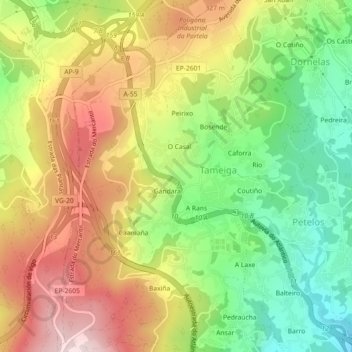
Name: Tameiga topographic map, elevation, terrain.
Location: Tameiga, Mos, Vigo, Pontevedra, Galicia, 36416, Spain (42.18134 -8.66908 42.21466 -8.63246)
Average elevation: 234 m
Minimum elevation: 53 m
Maximum elevation: 431 m
Thank you for supporting this site ❤️
Make a donation
Make a donation
Gear up for your next adventure:
As an Amazon Associate, this site earns from qualifying purchases at no extra cost to you.