
Tondela topographic map
Interactive map
Click on the map to display elevation.
About this map
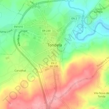
Name: Tondela topographic map, elevation, terrain.
Location: Tondela, Tondela e Nandufe, Tondela, Viseu, Portugal (40.50046 -8.09388 40.52762 -8.06638)
Average elevation: 303 m
Minimum elevation: 246 m
Maximum elevation: 366 m
Other topographic maps
Click on a map to view its topography, its elevation and its terrain.