
Lousberg topographic map
Interactive map
Click on the map to display elevation.
About this map
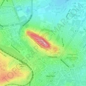
Name: Lousberg topographic map, elevation, terrain.
Average elevation: 179 m
Minimum elevation: 142 m
Maximum elevation: 261 m
Other topographic maps
Click on a map to view its topography, its elevation and its terrain.
Von-Halfern-Park
Germany > North Rhine-Westphalia > Aachen
Von-Halfern-Park, Kronenberg, Bildchen, Aachen-Mitte, Aachen, Städteregion Aachen, Cologne Government Region, North Rhine-Westphalia, 52074, Germany
Average elevation: 261 m