
Thank you for supporting this site ❤️
Make a donation
Make a donation
Gear up for your next adventure:
As an Amazon Associate, this site earns from qualifying purchases at no extra cost to you.
Texas topographic map
Click on the map to display elevation.
Thank you for supporting this site ❤️
Make a donation
Make a donation
Gear up for your next adventure:
As an Amazon Associate, this site earns from qualifying purchases at no extra cost to you.
About this map
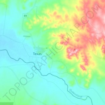
Name: Texas topographic map, elevation, terrain.
Location: Texas, Goondiwindi Regional, Queensland, 4385, Australia (-28.90880 151.11876 -28.79831 151.25821)
Average elevation: 333 m
Minimum elevation: 275 m
Maximum elevation: 492 m
Thank you for supporting this site ❤️
Make a donation
Make a donation
Gear up for your next adventure:
As an Amazon Associate, this site earns from qualifying purchases at no extra cost to you.