
Ernzen topographic map
Interactive map
Click on the map to display elevation.
About this map
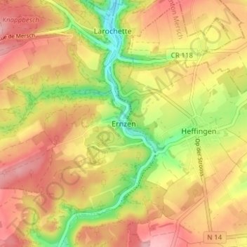
Name: Ernzen topographic map, elevation, terrain.
Location: Ernzen, Larochette, Canton Mersch, 7635, Luxembourg (49.75195 6.20169 49.79195 6.24169)
Average elevation: 347 m
Minimum elevation: 266 m
Maximum elevation: 407 m