
Thank you for supporting this site ❤️
Make a donation
Make a donation
Gear up for your next adventure:
As an Amazon Associate, this site earns from qualifying purchases at no extra cost to you.
Kasoa topographic map
Click on the map to display elevation.
Thank you for supporting this site ❤️
Make a donation
Make a donation
Gear up for your next adventure:
As an Amazon Associate, this site earns from qualifying purchases at no extra cost to you.
About this map
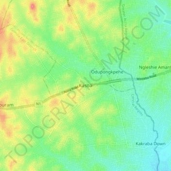
Name: Kasoa topographic map, elevation, terrain.
Location: Kasoa, Gomoa East District, Central Region, Ghana (5.49257 -0.47749 5.57257 -0.39749)
Average elevation: 31 m
Minimum elevation: 4 m
Maximum elevation: 77 m
Thank you for supporting this site ❤️
Make a donation
Make a donation
Gear up for your next adventure:
As an Amazon Associate, this site earns from qualifying purchases at no extra cost to you.