
Make a donation
Gear up for your next adventure:
As an Amazon Associate, this site earns from qualifying purchases at no extra cost to you.
Isernia topographic map
Click on the map to display elevation.
Make a donation
Gear up for your next adventure:
As an Amazon Associate, this site earns from qualifying purchases at no extra cost to you.
Isernia
The commune of Isernia includes 16 frazioni. The most densely populated is Castelromano which is positioned in a plain at the base of the La Romana mount, elevation 862 metres (2,828 ft), 5 kilometres (3 mi) from Isernia.
Make a donation
Gear up for your next adventure:
As an Amazon Associate, this site earns from qualifying purchases at no extra cost to you.
About this map
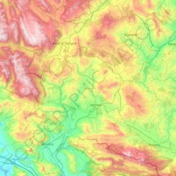
Name: Isernia topographic map, elevation, terrain.
Location: Isernia, Molise, Italy (41.38743 13.94102 41.91176 14.52225)
Average elevation: 886 m
Minimum elevation: 16 m
Maximum elevation: 2,273 m
Make a donation
Gear up for your next adventure:
As an Amazon Associate, this site earns from qualifying purchases at no extra cost to you.
Other topographic maps
Click on a map to view its topography, its elevation and its terrain.