Geolocate

Loriga topographic map

Click on the map to display elevation.

About this map
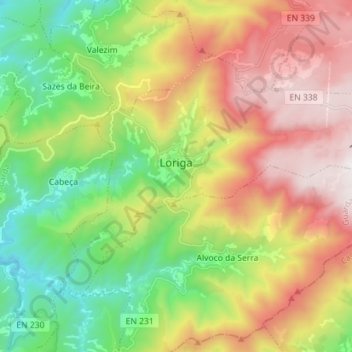
Name: Loriga topographic map, elevation, terrain.

Location: Loriga, Seia, Guarda, Portugal (40.28310 -7.73700 40.35783 -7.59530)

Average elevation: 1,016 m

Minimum elevation: 325 m

Maximum elevation: 1,938 m

Gear up for your next adventure:

🦟Anti-Midge & Tick Repellent - Vital for hiking in the Scottish Highlands during summer
⌚Altimeter Watches - Watches measuring altitude for mountain activities
🎒Hiking Child Carriers - Explore the outdoors with the whole family safely
🧼Biodegradable Soap - Leave-no-trace hygiene for multi-day mountain treks
🎿Telescopic Trekking Poles - Reduces knee strain on steep topographic descents

As an Amazon Associate, this site earns from qualifying purchases at no extra cost to you.