
Thank you for supporting this site ❤️
Make a donation
Make a donation
Gear up for your next adventure:
As an Amazon Associate, this site earns from qualifying purchases at no extra cost to you.
Pottammal topographic map
Click on the map to display elevation.
Thank you for supporting this site ❤️
Make a donation
Make a donation
Gear up for your next adventure:
As an Amazon Associate, this site earns from qualifying purchases at no extra cost to you.
About this map
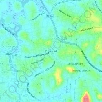
Name: Pottammal topographic map, elevation, terrain.
Location: Pottammal, Thondayad, Kozhikode, Kerala, 670016, India (11.24019 75.78832 11.28019 75.82832)
Average elevation: 20 m
Minimum elevation: 2 m
Maximum elevation: 86 m
Thank you for supporting this site ❤️
Make a donation
Make a donation
Gear up for your next adventure:
As an Amazon Associate, this site earns from qualifying purchases at no extra cost to you.