
Beericheri topographic map
Interactive map
Click on the map to display elevation.
About this map
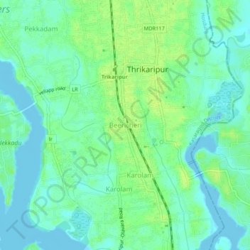
Name: Beericheri topographic map, elevation, terrain.
Location: Beericheri, Hosdurg, Kasaragod District, Kerala, 671311, India (12.11409 75.15732 12.15409 75.19732)
Average elevation: 7 m
Minimum elevation: -5 m
Maximum elevation: 14 m
Other topographic maps
Click on a map to view its topography, its elevation and its terrain.
Charakadvu
India > Kerala > Hosdurg > Karuvakkode
Charakadvu, Karuvakkode, Hosdurg, Kasaragod District, Kerala, 671316, India
Average elevation: 25 m
Kottakkani
Kottakkani, Hosdurg, Kasaragod District, Kerala, 671316, India
Average elevation: 23 m
Vellacheri
India > Kerala > Hosdurg > Chunda
Vellacheri, Chunda, Hosdurg, Kasaragod District, Kerala, India
Average elevation: 70 m
Kanhangad
India > Kerala > Hosdurg > Muriyanavi
Kanhangad, Muriyanavi, Hosdurg, Kasaragod district, Kerala, 671315, India
Average elevation: 19 m
Ambalathara
India > Kerala > Hosdurg > Gurupuram
Ambalathara, Gurupuram, Hosdurg, Kasaragod district, Kerala, India
Average elevation: 62 m