Geolocate

Ratekau topographic map

Click on the map to display elevation.

About this map
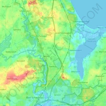
Name: Ratekau topographic map, elevation, terrain.

Location: Ratekau, Ostholstein, Schleswig-Holstein, Germany (53.91494 10.66061 54.01812 10.85061)

Average elevation: 20 m

Minimum elevation: -4 m

Maximum elevation: 73 m

Other topographic maps

Click on a map to view its topography, its elevation and its terrain.

Gear up for your next adventure:

👕Technical Hiking Tees - Moisture-management for high-exertion climbs
🧺Mesh Stuff Sacks - Breathable storage for wet gear or camp organization
🧥Breathable Waterproof Jackets - Essential rain protection for the unpredictable British climate
🧭Orienteering Compasses - Accurate compasses for map-based navigation
🚶Walking Pedometers - Simple distance tracking for casual trail walkers

As an Amazon Associate, this site earns from qualifying purchases at no extra cost to you.