Geolocate

Mauban topographic map

Click on the map to display elevation.

About this map
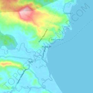
Name: Mauban topographic map, elevation, terrain.

Location: Mauban, Quezon, Calabarzon, 4330, Philippines (14.15005 121.69147 14.23005 121.77147)

Average elevation: 43 m

Minimum elevation: -4 m

Maximum elevation: 305 m

Gear up for your next adventure:

🥤Hiking Water Bottles - Reusable bottles for hydration on the trail
🧭GPS Trackers - Tracking devices for safety and navigation
📱Rugged Phone Cases - Heavy-duty protection for smartphones used as secondary GPS tools
🧢Thermal Beanie Hats - Prevent heat loss from the head in windy summit conditions
🗺️Ordnance Survey Maps - Official UK maps for walking and outdoor activities

As an Amazon Associate, this site earns from qualifying purchases at no extra cost to you.