Geolocate

Tolmie topographic map

Click on the map to display elevation.

About this map

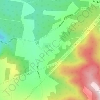
Name: Tolmie topographic map, elevation, terrain.

Location: Tolmie, Shire of Mansfield, Victoria, Australia (-36.95608 146.21888 -36.91608 146.25888)

Average elevation: 830 m

Minimum elevation: 640 m

Maximum elevation: 1,119 m

Gear up for your next adventure:

🦯Walking Poles - Supportive poles for long-distance walking
📢Survival Whistles - Essential safety gear for signaling for help in mountain fog
🧷Tenacious Repair Tape - Instant fix for torn tents, jackets, or dry bags
🧣Fleece Neck Warmers - Extra insulation for winter topographic surveys
🥤Hiking Water Bottles - Reusable bottles for hydration on the trail

As an Amazon Associate, this site earns from qualifying purchases at no extra cost to you.