
Oberreute topographic map
Interactive map
Click on the map to display elevation.
About this map
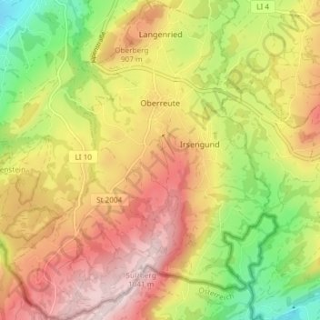
Name: Oberreute topographic map, elevation, terrain.
Average elevation: 830 m
Minimum elevation: 600 m
Maximum elevation: 1,041 m
Other topographic maps
Click on a map to view its topography, its elevation and its terrain.
Schreckenmanklitz
Germany > Bavaria > Landkreis Lindau > Weiler-Simmerberg
Schreckenmanklitz, Weiler-Simmerberg, Landkreis Lindau, Bavaria, 88161, Germany
Average elevation: 717 m
Gestratz
Germany > Bavaria > Landkreis Lindau > Gestratz
Gestratz, Argental (VGem), Landkreis Lindau, Bavaria, Germany
Average elevation: 698 m
Lindau (Bodensee)
Germany > Bavaria > Landkreis Lindau > Lindau (Bodensee)
Lindau (Bodensee), Landkreis Lindau, Bavaria, 88131, Germany
Average elevation: 448 m