Geolocate

Jubilee Playing Field & Athletics Track topographic map

Click on the map to display elevation.

About this map
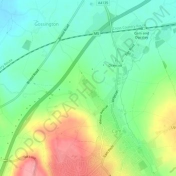
Name: Jubilee Playing Field & Athletics Track topographic map, elevation, terrain.

Location: Jubilee Playing Field & Athletics Track, Draycott, Cam, Stroud, Gloucestershire, England, United Kingdom (51.70644 -2.37479 51.71061 -2.36957)

Average elevation: 45 m

Minimum elevation: 8 m

Maximum elevation: 107 m

Gloucestershire trails, hiking, mountain biking, running and outdoor activities

Gear up for your next adventure:

📻Hand-Crank Emergency Radios - Stay updated on weather warnings in remote areas
🧦Hiking Socks - Breathable socks designed to prevent blisters on long walks
🔋Power Banks - Portable chargers for long outdoor trips
🥾Hiking Boots - Waterproof and durable boots for long-distance hiking in the UK
🦟Anti-Midge & Tick Repellent - Vital for hiking in the Scottish Highlands during summer

As an Amazon Associate, this site earns from qualifying purchases at no extra cost to you.