
Thank you for supporting this site ❤️
Make a donation
Make a donation
Gear up for your next adventure:
As an Amazon Associate, this site earns from qualifying purchases at no extra cost to you.
Ahmadnagar topographic map
Click on the map to display elevation.
Thank you for supporting this site ❤️
Make a donation
Make a donation
Gear up for your next adventure:
As an Amazon Associate, this site earns from qualifying purchases at no extra cost to you.
About this map
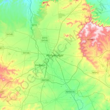
Name: Ahmadnagar topographic map, elevation, terrain.
Location: Ahmadnagar, Nagar, Ahmednagar, Maharashtra, 414001, India (18.93295 74.58935 19.25295 74.90935)
Average elevation: 692 m
Minimum elevation: 558 m
Maximum elevation: 963 m
Thank you for supporting this site ❤️
Make a donation
Make a donation
Gear up for your next adventure:
As an Amazon Associate, this site earns from qualifying purchases at no extra cost to you.