
Thank you for supporting this site ❤️
Make a donation
Make a donation
Gear up for your next adventure:
As an Amazon Associate, this site earns from qualifying purchases at no extra cost to you.
Morden topographic map
Click on the map to display elevation.
Thank you for supporting this site ❤️
Make a donation
Make a donation
Gear up for your next adventure:
As an Amazon Associate, this site earns from qualifying purchases at no extra cost to you.
About this map
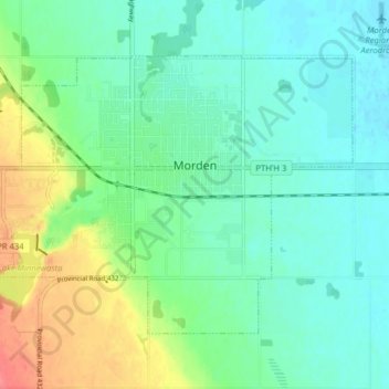
Name: Morden topographic map, elevation, terrain.
Location: Morden, Division No. 3, Manitoba, Canada (49.17026 -98.14856 49.20721 -98.06932)
Average elevation: 308 m
Minimum elevation: 290 m
Maximum elevation: 352 m
Thank you for supporting this site ❤️
Make a donation
Make a donation
Gear up for your next adventure:
As an Amazon Associate, this site earns from qualifying purchases at no extra cost to you.
Other topographic maps
Click on a map to view its topography, its elevation and its terrain.
Mount Nebo
Canada > Manitoba > Division No. 3 > Rural Municipality of Thompson
Average elevation: 395 m