Geolocate

Topton topographic map

Click on the map to display elevation.

About this map

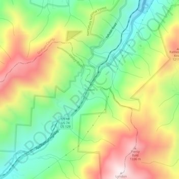
Name: Topton topographic map, elevation, terrain.

Location: Topton, Cherokee County, North Carolina, United States (35.22703 -83.72323 35.26703 -83.68323)

Average elevation: 980 m

Minimum elevation: 672 m

Maximum elevation: 1,388 m

Gear up for your next adventure:

🧢Waterproof Hiking Hats - Keep the rain off your face while studying topographic maps
🔋Solar Power Banks - Keep your GPS and phone charged during multi-day expeditions
👖Packable Overtrousers - Quick-deploy rain protection for legs in sudden storms
🥤Hydration Bladders - Hands-free hydration systems for backpacks
👟Men's Trail Running Shoes - Lightweight grip for fast movement over topographic contours

As an Amazon Associate, this site earns from qualifying purchases at no extra cost to you.