
Pirapora topographic map
Interactive map
Click on the map to display elevation.
About this map
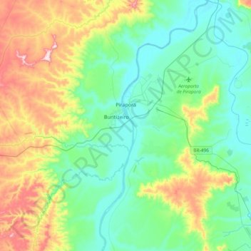
Name: Pirapora topographic map, elevation, terrain.
Average elevation: 586 m
Minimum elevation: 474 m
Maximum elevation: 878 m
Pirapora belongs to its own statistical microregion. The elevation of the municipal seat is 472 meters. It became a municipality in 1912. This municipality is located on the right bank of the São Francisco River and is 340 km from the state capital.