
Schlatenkees topographic map
Interactive map
Click on the map to display elevation.
About this map
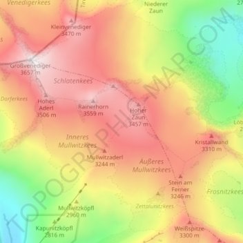
Name: Schlatenkees topographic map, elevation, terrain.
Average elevation: 2,949 m
Minimum elevation: 2,166 m
Maximum elevation: 3,632 m
Other topographic maps
Click on a map to view its topography, its elevation and its terrain.
Bobojach
Austria > Tyrol > Bezirk Lienz > Gemeinde Prägraten am Großvenediger
Bobojach, Gemeinde Prägraten am Großvenediger, Bezirk Lienz, Tyrol, 9974, Austria
Average elevation: 1,728 m