
Stapleton topographic map
Interactive map
Click on the map to display elevation.
About this map
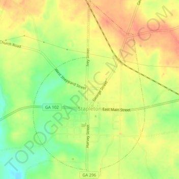
Name: Stapleton topographic map, elevation, terrain.
Location: Stapleton, Jefferson County, Georgia, United States (33.20323 -82.48010 33.23474 -82.45660)
Average elevation: 137 m
Minimum elevation: 108 m
Maximum elevation: 157 m
Other topographic maps
Click on a map to view its topography, its elevation and its terrain.
Jefferson County
United States > Georgia > Jefferson County
Jefferson County, Georgia, United States
Average elevation: 104 m