Geolocate

Kavieng topographic map

Click on the map to display elevation.

About this map

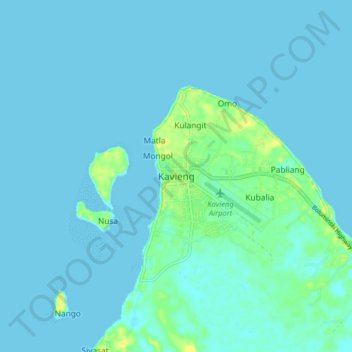
Name: Kavieng topographic map, elevation, terrain.

Location: Kavieng, New Ireland, Islands Region, Papua New Guinea (-2.61347 150.75522 -2.53347 150.83522)

Average elevation: 3 m

Minimum elevation: 0 m

Maximum elevation: 20 m

Other topographic maps

Click on a map to view its topography, its elevation and its terrain.

Lihir Island

Papua New Guinea > New Ireland

Average elevation: 71 m

Gear up for your next adventure:

🕶️Polarized Sunglasses - Reduces glare from snow and water when reading terrain
📦Compression Sacks - Reduce backpack volume efficiently
🔥Reusable Hand Warmers - Maintain dexterity in your fingers for precise map handling
🧥Breathable Waterproof Jackets - Essential rain protection for the unpredictable British climate
🥫Expedition Meals - Lightweight, high-calorie nutrition for long-distance hikers

As an Amazon Associate, this site earns from qualifying purchases at no extra cost to you.