Geolocate

Guestling topographic map

Click on the map to display elevation.

About this map

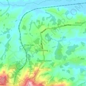
Name: Guestling topographic map, elevation, terrain.

Location: Guestling, Rother, East Sussex, England, United Kingdom (50.87855 0.58812 50.93058 0.66432)

Average elevation: 39 m

Minimum elevation: -2 m

Maximum elevation: 170 m

East Sussex trails, hiking, mountain biking, running and outdoor activities

Gear up for your next adventure:

📷Camera Straps - Secure straps for carrying cameras while walking
📕Outdoor Navigation Books - Learn traditional and modern navigation techniques
👟Women's Trail Running Shoes - Agile footwear for fell running and technical trails
🎒Multi-day Trekking Packs - Large capacity backpacks for wild camping and long-distance trails
Lightweight Solo Tents - Backpacking tents designed for wild camping in the UK highlands

As an Amazon Associate, this site earns from qualifying purchases at no extra cost to you.