
Thank you for supporting this site ❤️
Make a donation
Make a donation
Gear up for your next adventure:
As an Amazon Associate, this site earns from qualifying purchases at no extra cost to you.
Charlemagne topographic map
Click on the map to display elevation.
Thank you for supporting this site ❤️
Make a donation
Make a donation
Gear up for your next adventure:
As an Amazon Associate, this site earns from qualifying purchases at no extra cost to you.
About this map
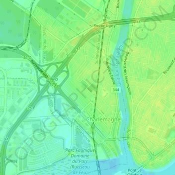
Name: Charlemagne topographic map, elevation, terrain.
Location: Charlemagne, L'Assomption (MRC), Lanaudière, Quebec, Canada (45.71253 -73.50231 45.73807 -73.48094)
Average elevation: 12 m
Minimum elevation: 4 m
Maximum elevation: 18 m
Thank you for supporting this site ❤️
Make a donation
Make a donation
Gear up for your next adventure:
As an Amazon Associate, this site earns from qualifying purchases at no extra cost to you.