
Saddleworth topographic map
Interactive map
Click on the map to display elevation.
About this map
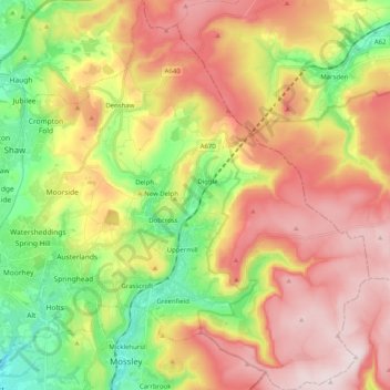
Name: Saddleworth topographic map, elevation, terrain.
Average elevation: 323 m
Minimum elevation: 109 m
Maximum elevation: 541 m
Other topographic maps
Click on a map to view its topography, its elevation and its terrain.
Harrop Dale
United Kingdom > England > Oldham > Diggle
Harrop Dale, Saddleworth, Diggle, Oldham, Greater Manchester, England, OL3 5PD, United Kingdom
Average elevation: 289 m