
Make a donation
Gear up for your next adventure:
As an Amazon Associate, this site earns from qualifying purchases at no extra cost to you.
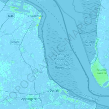
Delfzijl topographic map
Click on the map to display elevation.
Make a donation
Gear up for your next adventure:
As an Amazon Associate, this site earns from qualifying purchases at no extra cost to you.
Delfzijl
Delfzijl sits at an elevation above low tide, and usually above high tide except for a few days per year. The town is protected by dikes and gates that can be opened to let water out at low tide, and closed to prevent flooding at high tide. When normal draining at low tide is not sufficient water is pumped near Delfzijl at Farmsum in a modern pumping station that replaced the historical old pump house in the 1970s. The possibility of rising sea level is a large concern in Delfzijl, and storms have occasionally splashed water over the sea dikes in recent years causing the dike to be raised starting in 2017.
Make a donation
Gear up for your next adventure:
As an Amazon Associate, this site earns from qualifying purchases at no extra cost to you.
About this map
Name: Delfzijl topographic map, elevation, terrain.
Location: Delfzijl, Eemsdelta, Groningen, Netherlands (53.30611 6.88166 53.45943 7.10125)
Average elevation: 0 m
Minimum elevation: -7 m
Maximum elevation: 31 m
Make a donation
Gear up for your next adventure:
As an Amazon Associate, this site earns from qualifying purchases at no extra cost to you.
Other topographic maps
Click on a map to view its topography, its elevation and its terrain.
Make a donation
Gear up for your next adventure:
As an Amazon Associate, this site earns from qualifying purchases at no extra cost to you.