
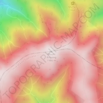
Mount Bogong topographic map
Interactive map
Click on the map to display elevation.
About this map
Name: Mount Bogong topographic map, elevation, terrain.
Location: Mount Bogong, Shire of East Gippsland, Victoria, Australia (-36.73242 147.30578 -36.73232 147.30588)
Average elevation: 1,719 m
Minimum elevation: 1,109 m
Maximum elevation: 1,985 m
The Big River separates the massif of the mountain from the Bogong High Plains to the south. From the nearby town of Mount Beauty to its summit, Mount Bogong rises more than 1,600 metres (5,200 ft), thus making it one of the highest peaks in Australia not only in terms of its elevation above sea level, but also in terms of actual base-to-summit prominence.
Other topographic maps
Click on a map to view its topography, its elevation and its terrain.
Clyde North
Australia > Victoria > Melbourne
Clyde North, Melbourne, City of Casey, Victoria, 3978, Australia
Average elevation: 38 m
Shire of Corangamite
Shire of Corangamite, Victoria, Australia
Average elevation: 151 m
Willow Grove
Willow Grove, Shire of Baw Baw, Victoria, 3825, Australia
Average elevation: 152 m
Gum Swamp, Miepol Wildlife Reserve (no hunting)
Gum Swamp, Miepol Wildlife Reserve (no hunting), Miepoll, Shire of Strathbogie, Victoria, Australia
Average elevation: 139 m
Coronet Bay
Australia > Victoria > Coronet Bay
Coronet Bay, Bass Coast Shire, Victoria, 3984, Australia
Average elevation: 13 m
Strathallan
Strathallan, Shire of Campaspe, Victoria, 3622, Australia
Average elevation: 106 m
Templestowe Lower
Australia > Victoria > Melbourne
Templestowe Lower, Melbourne, City of Manningham, Victoria, 3107, Australia
Average elevation: 55 m
Walkerville
Walkerville, Shire of South Gippsland, Victoria, Australia
Average elevation: 54 m
Shepherds Bush
Australia > Victoria > Melbourne
Shepherds Bush, Wantirna South, Melbourne, City of Knox, Victoria, Australia
Average elevation: 76 m
Ringwood North
Australia > Victoria > Melbourne
Ringwood North, Melbourne, City of Maroondah, Victoria, 3134, Australia
Average elevation: 137 m
Warrandyte South
Australia > Victoria > Melbourne
Warrandyte South, Melbourne, City of Manningham, Victoria, 3134, Australia
Average elevation: 106 m
Mount Buller
Mount Buller, Shire of Mansfield, Victoria, Australia
Average elevation: 824 m
Warranwood
Australia > Victoria > Melbourne
Warranwood, Melbourne, City of Maroondah, Victoria, 3134, Australia
Average elevation: 131 m
Walkerville North
Australia > Victoria > Walkerville
Walkerville North, Walkerville, Shire of South Gippsland, Victoria, 3956, Australia
Average elevation: 48 m
Wheelers Hill
Wheelers Hill, Shire of Hepburn, Victoria, Australia
Average elevation: 714 m
Cape Paterson
Cape Paterson, Bass Coast Shire, Victoria, 3995, Australia
Average elevation: 29 m
Falls Creek
Australia > Victoria > Falls Creek Alpine Resort
Falls Creek, Falls Creek Alpine Resort, Victoria, Australia
Average elevation: 1,459 m
Falls Creek Alpine Resort
Falls Creek Alpine Resort, Victoria, Australia
Average elevation: 1,491 m
Lancefield
Lancefield, Shire of Macedon Ranges, Victoria, 3435, Australia
Average elevation: 530 m
Dinner Plain
Dinner Plain, Alpine Shire, Victoria, 3898, Australia
Average elevation: 1,397 m
Larnoo Drive Reserve
Australia > Victoria > Melbourne
Larnoo Drive Reserve, Doncaster East, Melbourne, City of Manningham, Victoria, Australia
Average elevation: 69 m
Mount Beauty
Mount Beauty, Alpine Shire, Victoria, 3698, Australia
Average elevation: 564 m
Lake Mountain
Lake Mountain, Shire of Murrindindi, Victoria, Australia
Average elevation: 1,288 m
Korong Vale
Korong Vale, Shire of Loddon, Victoria, 3520, Australia
Average elevation: 149 m
Shire of Murrindindi
Shire of Murrindindi, Victoria, Australia
Average elevation: 447 m
Cranbourne North
Australia > Victoria > Melbourne
Cranbourne North, Melbourne, City of Casey, Victoria, 3977, Australia
Average elevation: 38 m
Mount Wycheproof
Australia > Victoria > Wycheproof
Mount Wycheproof, Wycheproof, Shire of Buloke, Victoria, 3527, Australia
Average elevation: 110 m