Geolocate

El Teniente topographic map

Click on the map to display elevation.

About this map
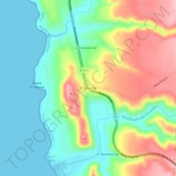
Name: El Teniente topographic map, elevation, terrain.

Location: El Teniente, Ovalle, Provincia de Limarí, Coquimbo Region, Chile (-31.00814 -71.65811 -30.96814 -71.61811)

Average elevation: 69 m

Minimum elevation: 0 m

Maximum elevation: 188 m

Other topographic maps

Click on a map to view its topography, its elevation and its terrain.

Gear up for your next adventure:

🧴Tick Removal Tools - Small, essential health tool for UK woodland and moorland
🧴Sport Sunscreen Sticks - High-protection sunblock that won't run into your eyes on the trail
🧺Microfibre Travel Towels - Fast-drying and compact towels for wild swimming and camping
🛑Emergency Bivvy Bags - Heat-reflective survival bags for unexpected nights out
👟Men's Trail Running Shoes - Lightweight grip for fast movement over topographic contours

As an Amazon Associate, this site earns from qualifying purchases at no extra cost to you.