Geolocate

Pantar topographic map

Click on the map to display elevation.

About this map

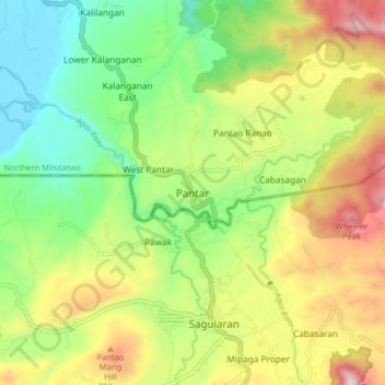
Name: Pantar topographic map, elevation, terrain.

Location: Pantar, Lanao del Norte, Northern Mindanao, Philippines (8.02122 124.22420 8.10122 124.30420)

Average elevation: 595 m

Minimum elevation: 360 m

Maximum elevation: 941 m

Gear up for your next adventure:

🔦LED Camping Lanterns - Illumination for reading maps inside your tent at night
🌂Windproof Trekking Umbrellas - Surprising but effective rain protection on low-wind trails
🥤Hiking Water Bottles - Reusable bottles for hydration on the trail
🕶️Glacier Goggles - Maximum protection for high-altitude snow topography
🧴Tick Removal Tools - Small, essential health tool for UK woodland and moorland

As an Amazon Associate, this site earns from qualifying purchases at no extra cost to you.