
Esposende topographic map
Interactive map
Click on the map to display elevation.
About this map
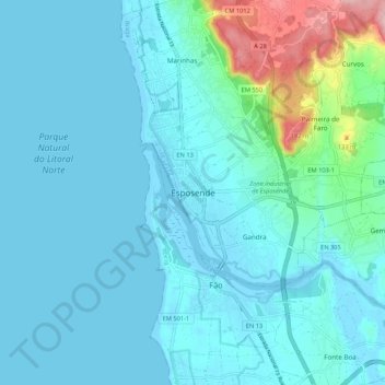
Name: Esposende topographic map, elevation, terrain.
Location: Esposende, Braga, Cávado, North, 4740-565, Portugal (41.49153 -8.81925 41.57153 -8.73925)
Average elevation: 28 m
Minimum elevation: -6 m
Maximum elevation: 212 m
Other topographic maps
Click on a map to view its topography, its elevation and its terrain.